Are you an adventurous soul who loves to explore the great outdoors? If so, then you know the importance of being able to navigate effectively while hiking. In this article, we will take you on a journey to discover the essential tools for safe navigation: maps and compasses. Whether you are a beginner or an experienced hiker, this guide will equip you with the knowledge and skills to confidently navigate any trail, ensuring you never lose your way. So lace up your boots, grab your gear, and let’s embark on an exciting adventure of mastering the art of navigation in hiking!


Choosing the Right Maps and Compasses
Understanding Topographic Maps
When it comes to hiking and outdoor navigation, topographic maps are an essential tool. These maps provide detailed information about the terrain, including elevation, landforms, and other important features. Understanding how to read and interpret topographic maps is crucial for safe and successful navigation.
Important Features to Look for in a Topographic Map
When choosing a topographic map for hiking, there are a few key features to look for. First and foremost, the map should have a scale that suits your needs. The scale will determine the level of detail shown on the map, so it’s important to choose one that provides sufficient information for your planned route.
Another important feature to consider is the contour interval. Contour lines on a topographic map indicate changes in elevation, and the contour interval determines the vertical distance between each line. A smaller contour interval means more detailed elevation information on the map.
In addition to the scale and contour interval, it’s also important to choose a topographic map that includes relevant features such as trails, water sources, campsites, and landmarks. These features can greatly assist in planning and navigation during your hike.
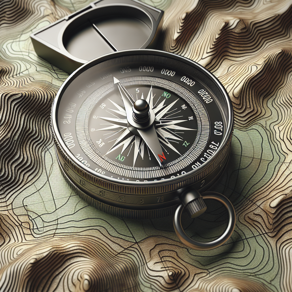
Types of Compasses and Their Uses
Compasses are valuable tools for navigation, allowing hikers to determine directions and bearings. There are several types of compasses available, each with its own specific uses.
The most common type of compass is the magnetic needle compass. This compass uses a magnetized needle that aligns itself with the Earth’s magnetic field, pointing towards magnetic north. Magnetic compasses are reliable and easy to use, making them a popular choice for hikers.
Another type of compass is the baseplate compass, which features a transparent baseplate with a ruler and protractor, making it easier to measure distances and angles on a map. These compasses are especially useful for advanced navigation techniques such as triangulation.
There are also specialized compasses available for specific purposes, such as walking compasses designed for navigation on foot, or compasses with built-in clinometers for measuring angles of slope. Choosing the right compass depends on your specific needs and the level of navigation you plan to engage in during your hike.
Key Considerations when Choosing a Compass
When choosing a compass for hiking, there are several key considerations to keep in mind. Firstly, it’s important to select a compass that is durable and water-resistant, as it will likely be exposed to the elements during your outdoor adventures. Look for a compass with a robust construction and a transparent baseplate made of high-quality material.
Another important consideration is the adjustability of the compass. Many compasses allow for declination adjustments, which compensates for the difference between true north (geographic north) and magnetic north. This adjustment is crucial for accurate navigation, especially in areas with significant magnetic declination.
Finally, consider the readability of the compass. Look for a compass with clear markings and a large enough dial, making it easy to read in various lighting conditions. It’s also beneficial to choose a compass with luminous markers for nighttime navigation.
By carefully considering these aspects, you can choose a compass that suits your needs and enhances your hiking experience.
Reading Topographic Maps
Understanding Map Symbols and Colors
When reading a topographic map, it’s important to familiarize yourself with the various symbols and colors used to represent different features. Each symbol and color on the map conveys important information about the natural and man-made elements of the terrain.
For example, contour lines, which are the curved lines on the map, represent changes in elevation. By understanding the contour interval, you can determine the steepness and shape of the land.
Other symbols on the map denote vegetation types, such as forests or grasslands, as well as water bodies, such as lakes or rivers. These symbols help you identify different types of terrain and plan your route accordingly.
Additionally, map colors can provide valuable information about the landscape. For instance, blue is commonly used to represent water features, while green indicates vegetation. Understanding these color codes can aid in locating water sources or planning alternate routes.
Interpreting Contour Lines
Contour lines are a fundamental feature of topographic maps, and understanding how to interpret them is crucial for accurate navigation. Contour lines are continuous curves that connect points of equal elevation on the map.
By closely observing the contour lines, you can determine the shape of the land. For instance, contour lines that are closely spaced indicate steep terrain, whereas widely spaced contour lines suggest gentle slopes. Additionally, the direction in which the contour lines bend can indicate valleys, ridges, or other landforms.
The contour interval, which specifies the vertical distance between each contour line, provides further information about the elevation changes in the area. By paying attention to the contour interval, you can estimate the height of hills or mountains and plan a safer route.
Identifying Terrain Features
Topographic maps provide valuable information about the various terrain features you may encounter during your hike. By understanding how to identify these features on the map, you can better navigate through the landscape.
Some common terrain features depicted on topographic maps include hills, valleys, ridges, and depressions. By studying the contour lines and their arrangement, you can identify these features and plan your route accordingly. For example, following ridge lines might offer a more straightforward path, while avoiding areas with closely spaced contour lines could spare you from steep ascents or descents.
Another important feature to watch for is bodies of water. Topographic maps often show lakes, rivers, or streams, which can be vital for locating water sources during your hike.
Using Scale and Legend
The scale of a topographic map indicates the relationship between distances on the map and the actual distances in the field. Understanding the scale is crucial for calculating distances and estimating travel times.
The scale can be expressed in various ways, such as representative fraction or a bar scale. A representative fraction scale of 1:24,000 means that one unit on the map equals 24,000 units in the field. By utilizing the scale, you can convert map distances to real-world distances and vice versa.
The legend is another essential element found on topographic maps. It provides explanations for the various symbols and colors used on the map. The legend helps you accurately interpret the map and understand the meaning behind each symbol, so you can navigate with confidence.
Recognizing North and Magnetic Declination
Knowing the directions of north and south is crucial for successful navigation. Topographic maps typically contain a north arrow, which indicates the orientation of the map relative to the actual north.
It’s important to distinguish between two types of north: true north (geographic north) and magnetic north. True north aligns with the Earth’s axis, while magnetic north is the direction a compass needle points towards.
Magnetic declination refers to the difference between true north and magnetic north at a specific location. This declination can vary depending on your geographic location and should be taken into account when using a compass for navigation.
By recognizing the importance of north and understanding magnetic declination, you can ensure accurate navigation with the help of your compass.

Orienting the Map
Understanding Magnetic North and True North
To effectively use a compass in conjunction with a map, it’s important to understand the difference between magnetic north and true north. Magnetic north is the direction in which a compass needle points, while true north refers to the Earth’s geographic north pole.
Knowing these distinctions is crucial because maps are typically oriented to true north. By understanding how to align the map and the compass, you can navigate accurately using the features on the map in combination with the compass’s magnetic bearing.
Using a Compass to Orient the Map
To orient the map, start by laying it flat on a level surface. Next, place the compass on the map so that the direction of travel arrow points towards the top of the map (true north). Then, rotate the map and the compass together until the magnetic needle aligns with the orienting arrow on the compass.
Once the map is oriented, you can use the features on the map and the compass to accurately navigate through the terrain. By keeping the map oriented throughout your hike, you can easily refer to it for guidance.
Aligning Map Grid Lines with Compass Bearings
In addition to orienting the map to true north, it’s also helpful to align the map’s grid lines with the compass bearings. Grid lines on a map are typically represented by a series of horizontal and vertical lines, forming a grid pattern.
To align the map grid lines with the compass bearings, hold the compass flat on the map with the edge of the compass baseplate aligning with the desired grid line. Then, rotate the compass housing until the orienting lines are parallel with the grid lines.
This alignment allows you to easily read grid coordinates, plan routes, and navigate accurately using both the compass and the map.
Using a Compass
Determining Azimuth and Bearings
When it comes to hiking and navigation, understanding azimuth and bearings is key. Azimuth refers to the angle between two points measured clockwise from true north, while a bearing is the direction or line of travel between two points measured clockwise from magnetic north.
To determine the azimuth or bearing between two points, simply align the compass with the first point and then turn the compass housing until the index line aligns with the second point. The degree reading on the compass bezel indicates the azimuth or bearing.
By mastering the use of azimuth and bearings, you can accurately navigate from one point to another, regardless of the distance or complexity of the terrain.
Taking a Bearing to a Landmark
Taking bearings to landmarks can be a useful technique when you need to identify a specific location or navigate towards a prominent feature. By using a compass, you can determine the bearing towards the landmark and use it as a reference for your navigation.
To take a bearing to a landmark, simply aim the direction of travel arrow on your compass towards the landmark and rotate the compass housing until the magnetic needle aligns with the orienting arrow. The degree reading on the compass bezel is the bearing to the landmark.
Taking bearings to landmarks can help you stay on track, locate key points of interest, and navigate accurately in challenging environments.
Following a Bearing for Navigation
Once you have determined a bearing to your destination, it’s important to follow that bearing to stay on course during your hike. By maintaining the correct direction, you can avoid getting lost or straying off your intended route.
To follow a bearing, keep the direction of travel arrow on your compass aligned with the desired bearing. As you hike, periodically check your compass to ensure you are maintaining the correct direction. Adjust your course as needed to account for any natural obstacles or deviations from the planned route.
By consistently following a bearing, you can confidently navigate through unfamiliar terrain and reach your destination safely.
Adjusting for Magnetic Declination
As mentioned earlier, magnetic declination is the angle between true north and magnetic north. It can vary depending on your location and should be taken into account when navigating with a compass. Failing to adjust for magnetic declination can result in inaccurate navigation.
To adjust for magnetic declination, locate the specific declination value for your area, either from your topographic map or from online sources. Once you have this value, adjust your compass by rotating the compass housing or aligning the declination scale with the orienting arrow. This adjustment ensures that the bearings you take align with true north rather than magnetic north.
By accounting for magnetic declination, you can navigate with precision and avoid potential errors during your hike.
Using Triangulation for Position Fixing
Triangulation is a powerful technique that can help you accurately determine your position on a map. By taking bearings to at least two prominent features or landmarks, you can create imaginary lines on the map that intersect at your location.
To use triangulation, choose two distinct features that are both visible from your current position. Take a bearing to the first feature and mark it on your map. Repeat the process with the second feature. The point where the two bearings intersect is your approximate position on the map.
Triangulation provides a reliable method for fixing your position, especially in areas with complex terrain or limited visibility. By utilizing this technique, you can enhance your navigation skills and confidently explore new hiking destinations.


Navigating with Maps and Compasses
Route Planning and Preparing
Before you hit the trail, it’s crucial to plan your route and prepare adequately. Start by studying the topographic map of your intended hiking area. Identify important landmarks, water sources, campsites, and potential hazards. By understanding the terrain and possible challenges, you can plan a safe and enjoyable route.
When planning your route, consider factors such as distance, elevation changes, and estimated travel time. Take into account your fitness level and the conditions you may encounter along the way, such as rugged terrain or inclement weather. It’s also wise to have alternative routes or contingency plans in case of unexpected obstacles or changes in weather conditions.
As part of your preparation, ensure you have the necessary gear and provisions for your hike. Pack essential navigation tools such as a map, compass, and any other equipment that suits your needs. Additionally, make sure you have appropriate clothing, sufficient food and water, a first aid kit, and other items essential for a safe and comfortable hike.
By carefully planning your route and preparing accordingly, you can embark on your hiking adventure with confidence and peace of mind.
Using Map and Compass together for Navigation
When it comes to navigation, using a map and compass together is a powerful combination. These tools complement each other and provide a comprehensive navigation system for outdoor adventures.
Start by orienting the map using your compass, aligning the features on the map with the compass’s magnetic bearing. Use the map to identify landmarks and visualize your route. Take bearings to prominent features as reference points and use them to guide your navigation.
Periodically check your compass to ensure you are following the correct bearing and make any necessary adjustments along the way. Use the map to confirm your location, estimate distances, and identify potential hazards or route changes.
By using the map and compass together, you can navigate with precision, stay on track, and make informed decisions during your hike.
Recognizing and Correcting for Errors
Even with careful planning and navigation, it’s important to recognize and correct for any errors that may occur during your hike. Errors can be caused by various factors such as misreading the map, misinterpreting terrain features, or veering off course.
To recognize errors, regularly compare the features on the map with the ones you observe in the field. Pay attention to distinctive landmarks, contour lines, and other indicators to confirm your location. If you notice significant discrepancies, stop and reassess your navigation.
To correct errors, use your compass to determine your current position and adjust your course accordingly. Retrace your steps if necessary or find an alternative route. Remember to take note of any changes you make to ensure accurate navigation and avoid repeating errors.
By being vigilant and proactive in recognizing and correcting errors, you can maintain your safety and prevent potential mishaps during your hike.
Estimating Distance and Travel Time
Estimating distance and travel time is crucial for effective route planning and navigation. By accurately assessing these factors, you can plan realistic itineraries and ensure you have ample time to reach your destination.
To estimate distance, use the scale on the map and convert it to real-world distances using the map’s scale factor. Measure the length of your intended route using the scale and consider the prevailing terrain and conditions. Keep in mind that travel time can vary based on elevation changes, trail conditions, and your own fitness level.
A common rule of thumb is to estimate an average hiking speed of 2-3 miles per hour (3.2-4.8 kilometers per hour) on moderate terrain. Adjust this estimate based on the factors specific to your hike.
Remember to account for additional time needed for breaks, rest, and exploration. It’s better to plan conservatively and allow for extra time than to rush and risk not reaching your destination safely.
By accurately estimating distance and travel time, you can plan your hike realistically, avoid unnecessary stress, and enjoy your outdoor adventure to the fullest.
Resolving Common Navigation Challenges
Navigating in Poor Visibility or at Night
Navigating in poor visibility conditions or at night requires additional precautions and techniques. Reduced visibility can occur due to fog, rain, snow, or darkness, making it challenging to navigate with traditional methods.
During poor visibility, it’s crucial to rely on other senses and techniques. Pay close attention to the terrain and rely on features such as distinctive rock formations or vegetation patterns to orient yourself. Use your compass to maintain a bearing and stay on course.
It’s also helpful to use additional tools such as a headlamp or flashlight to illuminate the map and compass. Consider using reflective markers or glow sticks to mark key points along your route, ensuring you can find your way back if needed.
If navigating at night, be aware of potential hazards such as uneven terrain, loose rocks, or tree branches. Proceed with caution and adjust your pace accordingly.
Navigating in poor visibility or at night requires extra care and attention. By utilizing alternative techniques and being prepared with appropriate equipment, you can navigate safely even in challenging conditions.
When to Use GPS vs. Maps and Compasses
In the age of technology, GPS devices have become increasingly popular for navigation. While GPS devices offer convenience and accuracy, it’s important to consider their limitations and when it’s appropriate to rely on traditional maps and compasses.
GPS devices provide precise location data and can be valuable tools, especially in unfamiliar or complex terrain. They can quickly calculate distances, monitor your progress, and offer waypoint navigation. However, GPS devices rely on satellite signals, which can be affected by obstacles such as dense tree cover or steep canyon walls. They also require a power source and can be prone to technical failures or malfunctions.
On the other hand, maps and compasses are reliable and do not require any external power sources. They allow for broader situational awareness and can be used in conjunction with other navigation techniques, such as triangulation or dead reckoning.
There is no one-size-fits-all answer to whether to use GPS or traditional navigation tools. It’s important to consider the specific circumstances, personal preferences, and needs of your hike. In many situations, a combination of GPS and map/compass can provide the best of both worlds, offering accuracy and redundancy for a safer and more enjoyable hiking experience.
Dealing with Unexpected Obstacles
Nature is full of surprises, and unexpected obstacles can arise during your hike. These obstacles can range from fallen trees blocking the trail to sudden weather changes or impassable terrain.
When faced with unexpected obstacles, it’s important to stay calm and assess the situation. Rely on your map and compass to identify alternate routes or bypasses. Look for visible landmarks or terrain features that can guide you around the obstacle.
If necessary, backtrack to a previously navigated point and find an alternative path. Take note of the obstacles and any route changes you make to ensure accurate navigation when retracing your steps.
In some cases, it may be necessary to adjust your route or even abandon your original plan if the obstacle poses a significant risk or if it is beyond your capabilities. Prioritize safety and make informed decisions to ensure a successful and enjoyable hiking experience.
Handling Deviations from Planned Route
Deviation from the planned route can happen for various reasons, such as encountering unexpected obstacles, changes in weather conditions, or simple human error. It’s important to handle these deviations calmly and make informed decisions to stay on track.
First, stop and assess the situation. Determine your current location using your map and compass. Refer to prominent landmarks or terrain features to confirm your position. Based on this information, evaluate the best course of action and identify any potential alternate routes.
If the deviation is minor and poses no significant risks, you can make adjustments to get back on track, either by retracing your steps or finding alternative paths. Adjust your bearings or waypoints accordingly and proceed with caution.
In some cases, the deviation may require a change in your overall plan. If the new route or destination aligns with your goals and capabilities, adjust your plans accordingly. Be flexible and adapt to the circumstances while prioritizing safety and enjoyment.
By handling deviations from the planned route effectively, you can navigate through unexpected situations and ensure a successful hiking experience.


Navigation Tips and Techniques
Maintaining a Pace Count
A pace count is a technique that helps you estimate the distance you’ve traveled based on the number of steps you have taken. Establishing a pace count can be useful for estimating distances when no other means of measurement are available.
To determine your pace count, measure a known distance, such as 100 meters or yards, and count how many steps it takes you to cover that distance. Repeat this process several times to get an average pace count. For example, if it takes you 60 steps to walk 100 meters, your pace count is 60 steps per 100 meters.
Once you have established your pace count, you can use it to estimate distances during your hike. Count your steps as you walk, and multiply the number of steps by the appropriate factor to estimate the distance covered.
Maintaining a pace count can be a valuable tool when other forms of measurement are not feasible. It allows you to estimate distances and travel times, enhancing your navigation skills in a variety of terrains.
Using Landmarks and Waypoints
Navigating using landmarks and waypoints is an effective technique for simplifying complex routes and improving accuracy. Landmarks are distinctive features in the landscape, such as mountains, rock formations, or buildings, that can be easily identified on a map and observed in the field.
To utilize landmarks and waypoints effectively, start by identifying the prominent features along your intended route on the map. Take note of their distances and bearings from your starting point or other reference points.
As you hike, continuously refer to your map and identify these landmarks in the field. Confirm their identities and make any necessary adjustments to your navigation based on their positions.
By using landmarks and waypoints, you can simplify your navigation, validate your position, and avoid unnecessary detours or errors.
Dead Reckoning and Handrailing
Dead reckoning and handrailing are navigation techniques that can be used when there are no distinct landmarks or features to follow. These techniques rely on estimating and maintaining a constant direction and distance.
Dead reckoning involves determining a specific bearing and maintaining that direction for a known distance. By pacing or estimating the distance covered, you can navigate through featureless terrain without the need for visual references. It’s crucial to regularly check your compass and adjust your course as needed to maintain accuracy.
Handrailing, on the other hand, involves following a linear feature, such as a trail, river, or coastline, as a reference point. By navigating parallel to the feature at a constant distance, you can ensure that you remain on course. Regularly refer to the map to confirm your position and make adjustments if necessary.
Both dead reckoning and handrailing are valuable techniques for navigating in terrain that offers limited or no distinct features. By mastering these techniques, you can confidently navigate through challenging environments and reach your destination safely.
Backtracking and Retracing Steps
Backtracking or retracing steps is a technique used when you need to return to a previously navigated point. This can occur if you have deviated from your planned route, encountered an unexpected obstacle, or simply need to revisit a specific location.
To backtrack, consult your map and identify the point you wish to return to. Use your compass to determine the bearing or direction back to that point. Begin retracing your steps, carefully following the bearings and waypoints you initially used.
While it may seem counterintuitive to revert to a previous location, backtracking can often be the safest and most efficient way to navigate. By retracing your steps, you can regain your bearings, correct any errors, and continue your hike with confidence.
By utilizing backtracking techniques effectively, you can navigate through unexpected situations and minimize the risks associated with uncertain navigation.
Safety Precautions for Navigation
Telling Someone Your Route Plan
Before embarking on a hiking trip, it’s essential to inform someone about your route plan. Share your intended hiking route, expected time of arrival, and any relevant details regarding your trip.
Provide the contact person with a copy of your map and highlight your planned route. If possible, provide an estimated time of return and specify what actions should be taken in case you do not return within a reasonable timeframe.
By sharing your route plan with a trusted person, you ensure that someone is aware of your whereabouts and can raise the alarm if necessary. This precaution is crucial for your safety, especially in the event of an emergency or if you encounter unexpected difficulties.
Being Aware of Potential Hazards
It’s important to be aware of potential hazards and risks associated with the hiking area you plan to explore. Study the topographic map and identify areas with steep slopes, rugged terrain, or dense vegetation that may hinder navigation.
Take note of hazardous cliffs, areas prone to flooding or rockfall, and other known risks. Consider local weather patterns and potential changes that may affect your hike.
Educate yourself about wildlife in the area and take appropriate precautions to avoid conflicts or potential encounters. Be familiar with any safety regulations or restrictions imposed by the local authorities.
By being aware of potential hazards, you can plan your route accordingly, take necessary precautions, and make informed decisions during your hike.
Knowing Emergency Contact Information
Before heading out on a hike, it’s crucial to know emergency contact information for the local area. Save the contact numbers for emergency services, park rangers, or local authorities in your phone or carry them with you in case of an emergency.
Familiarize yourself with the nearest medical facilities and know their addresses and contact numbers. Ensure you have a clear understanding of the emergency procedures specific to the hiking area.
In the event of an emergency, remain calm and contact the appropriate authorities immediately. Provide accurate and detailed information about your location, the nature of the emergency, and any relevant medical conditions.
Knowing emergency contact information and procedures can save critical time and potentially save lives during a hiking emergency.
Packing Essential Navigation Tools
When preparing for a hike, it’s essential to pack the necessary navigation tools to ensure a safe and successful trip.
First and foremost, pack the appropriate topographic maps for your hiking area. Study the maps beforehand and mark your planned route using a highlighter or pen. Consider laminating the maps or using a waterproof map case to protect them from moisture.
A reliable compass is another essential tool. Choose a compass suitable for your navigation needs, ensuring that it is durable, water-resistant, and easy to read. Pack spare batteries if your compass is battery-operated.
Additionally, consider carrying a GPS device as a backup or supplementary navigation tool. Ensure that it is fully charged and loaded with the necessary maps or waypoints.
Other essential navigation tools to pack include a protractor or ruler for measuring distances and angles on the map, a pencil for marking features or recording route changes, and a reliable watch or timekeeping device for estimating travel time.
By packing these essential navigation tools, you equip yourself with the means to navigate confidently and accurately during your hike.

Improving Navigation Skills
Practicing Map and Compass Usage
Improving navigation skills requires practice and familiarity with map and compass usage. Take the time to practice using your tools in a variety of settings and terrains before embarking on challenging hiking adventures.
Start by practicing basic map reading skills, such as interpreting contour lines, identifying terrain features, and understanding map symbols and colors. Familiarize yourself with the scale, legend, and other key elements of topographic maps.
Next, practice using your compass to orient the map, take bearings, follow bearings, and adjust for magnetic declination. Develop a routine for using your compass in conjunction with the map to ensure accurate navigation.
Consider participating in orienteering events or joining navigation workshops to enhance your skills. These activities provide valuable opportunities to practice navigation techniques, gain confidence, and learn from experienced navigators.
By regularly practicing map and compass usage, you can improve your navigational abilities, boost your confidence, and enhance your overall hiking experience.
Taking Navigation Courses
For those who want to take their navigation skills to the next level, enrolling in formal navigation courses can be highly beneficial. Navigation courses offer structured learning opportunities and hands-on training under the guidance of experienced instructors.
These courses teach advanced navigation techniques, provide in-depth understanding of maps and compasses, and develop situational awareness and decision-making skills. They often include practical exercises and field trips to apply the learned concepts in real-life situations.
Before enrolling in a navigation course, research reputable providers and consider their track record and the qualifications of their instructors. Look for courses that align with your skill level and specific areas of interest.
By investing in navigation courses, you can gain valuable knowledge, receive expert guidance, and accelerate your progression as a skilled navigator.
Learning Advanced Techniques
Advanced navigation techniques can significantly enhance your skills and provide you with additional tools for challenging hiking situations. Once you have mastered the basics, consider exploring advanced techniques to further expand your knowledge and abilities.
Some advanced techniques include celestial navigation, which involves using the sun, stars, or moon to determine direction, and GPS navigation, which utilizes satellite signals for precise positioning and route guidance.
Other advanced techniques include pace counting with uphill and downhill corrections, using resection to determine your position, and utilizing handheld clinometers for measuring slopes or heights.
Learning advanced techniques can be achieved through self-study using books and online resources, or through advanced navigation courses and workshops. By continuously learning and challenging yourself, you can become a proficient navigator and tackle more complex hiking adventures.
Getting Familiar with Local Terrain
Becoming familiar with the local terrain of your hiking area is essential for successful navigation. Prioritize spending time exploring the area, gaining firsthand knowledge and experiencing the unique features and challenges of the landscape.
Study local hiking guidebooks or consult with experienced hikers to learn about recommended routes, iconic landmarks, and possible navigation difficulties. Take note of any local regulations or restrictions applicable to the area.
Spend time hiking on established trails, closely following maps and observing the terrain. Practice using your compass and navigating through various terrains such as forests, mountains, or open plains.
By getting familiar with the local terrain, you can fine-tune your navigation skills, develop confidence in your abilities, and make the most of your hiking experiences.
Conclusion
The importance of navigation skills in hiking cannot be overstated. Mastering the use of maps and compasses enhances safety and enjoyment during outdoor adventures, allowing hikers to explore new terrains confidently and navigate through challenging situations.
Choosing the right maps and compasses is the first step towards successful navigation. Understanding topographic maps, their features, and the types of compasses available helps hikers make informed decisions when selecting their navigation tools.
Reading topographic maps and interpreting their symbols, colors, and contour lines is crucial for effective navigation. Orienting the map and understanding magnetic north ensure accurate alignment with the compass.
Using a compass provides essential information such as azimuth and bearings, allowing hikers to navigate with precision. Utilizing advanced techniques like triangulation and dead reckoning further enhances navigational abilities.
Navigating with maps and compasses involves route planning and preparation, using the tools together for guidance, recognizing and correcting errors, and estimating distances and travel time.
Resolving common navigation challenges such as poor visibility, unexpected obstacles, deviations from the planned route, and choosing between GPS and traditional navigation tools ensures safe and successful hiking experiences.
Implementing navigation tips and techniques including maintaining a pace count, using landmarks and waypoints, employing dead reckoning and handrailing, and knowing when to backtrack aid in accurate and efficient navigation.
Taking safety precautions such as informing someone of your route plan, being aware of potential hazards, knowing emergency contact information, and packing essential navigation tools are essential for safe hiking.
Improving navigation skills through practicing map and compass usage, taking navigation courses, learning advanced techniques, and getting familiar with local terrain empowers hikers to confidently navigate through various environments.
In conclusion, mastering the use of maps and compasses is a valuable skill that enhances safety, enjoyment, and the overall hiking experience. By embracing these navigation tools and techniques, hikers can explore the great outdoors with confidence and embark on memorable adventures.
